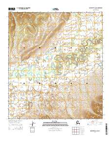
2015 Map of Unalakleet D-3 NE
USGS Topo · Published 2015About this map
Iditarod Trail To Kaltag cuts across this landscape, tracing a historic overland route through the eastern stretches of the Norton Sound region. The terrain is defined by the winding course of the Unalakleet River, which exhibits a complex pattern of oxbows and meanders as it flows toward the coast. To the southwest, the Alukuk Hills rise above the river valley, providing a distinct topographic boundary to the low-lying wetlands and creek systems. Smaller waterways like Steve Cr drain the surrounding slopes, illustrating the intricate hydrography of the Alaskan interior. This 2015 survey captures the intersection of traditional travel corridors and the natural drainage patterns of the subarctic wilderness.
Find a feature on this map
10 named features on this map. Tap any name to fly to it.
Don’t see what you’re looking for? This feature index may not catch every label — zoom into the map to look around manually.
Map Details
Editions of this 2015 Unalakleet D-3 NE Map
This is the sole edition of this map. No revisions or reprints were ever made.
Other maps of this area

1948 · Norton Bay
USGS Topo · 1:250,000

1950 · Unalakleet D-3
USGS Topo · 1:63,360

1950 · Norton Bay A-3
USGS Topo · 1:63,360

1951 · Unalakleet
USGS Topo · 1:250,000

1951 · Norton Bay
USGS Topo · 1:250,000

1952 · Unalakleet D-2
USGS Topo · 1:63,360

1952 · Unalakleet
USGS Topo · 1:250,000
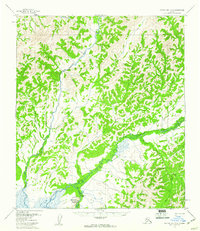
1953 · Norton Bay A-2
USGS Topo · 1:63,360

1955 · Norton Bay
USGS Topo · 1:250,000

1964 · Unalakleet
USGS Topo · 1:250,000