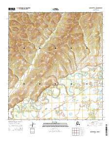
2015 Map of Unalakleet D-3 NW
USGS Topo · Published 2015About this map
The Iditarod Trail To Kaltag cuts across the southern portion of this landscape, marking a historic route of travel through the Alaska wilderness. The terrain is defined by the winding course of the Unalakleet River and its junction with the Chiroskey River, where the water creates complex oxbows and marshy lowlands. To the east, the Alukuk Hills rise above the river valley, providing a contrast to the riparian flats near Tea Cr. In the northern uplands, the presence of Musk Ox Hill Rd indicates modern access into the higher elevations. This map captures a region where traditional long-distance trails and natural waterways remain the primary features of the land, illustrating the persistent importance of the river systems for navigation and the legacy of the Iditarod route.
Find a feature on this map
12 named features on this map. Tap any name to fly to it.
Don’t see what you’re looking for? This feature index may not catch every label — zoom into the map to look around manually.
Map Details
Editions of this 2015 Unalakleet D-3 NW Map
This is the sole edition of this map. No revisions or reprints were ever made.
Other maps of this area

1948 · Norton Bay
USGS Topo · 1:250,000

1950 · Unalakleet D-3
USGS Topo · 1:63,360

1950 · Norton Bay A-4
USGS Topo · 1:63,360

1950 · Norton Bay A-3
USGS Topo · 1:63,360

1950 · Unalakleet D-4
USGS Topo · 1:63,360

1951 · Unalakleet
USGS Topo · 1:250,000

1951 · Norton Bay
USGS Topo · 1:250,000

1952 · Unalakleet
USGS Topo · 1:250,000

1955 · Norton Bay
USGS Topo · 1:250,000

1964 · Unalakleet
USGS Topo · 1:250,000