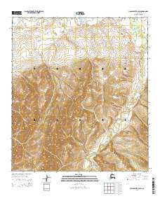
2015 Map of Unalakleet D-3 SW
USGS Topo · Published 2015About this map
The Nulato Hills dominate the topography of this portion of the Unalakleet region, showing the complex drainage systems of the interior. The Chiroskey River winds through the eastern portion of the quadrangle, joined by smaller tributaries like Tea Cr and Rabbit Cr. This 2015 survey illustrates a landscape largely defined by its natural hydrology and elevation, with very little modern infrastructure visible beyond the presence of Eaton Station Road cutting through the northwestern corner. The map provides a precise record of the terrain and watercourses in the Unalakleet D-3 SW area, serving as a primary source for understanding the physical geography of this part of the Alaska interior near the Norton Sound drainage basin.
Find a feature on this map
9 named features on this map. Tap any name to fly to it.
Don’t see what you’re looking for? This feature index may not catch every label — zoom into the map to look around manually.
Map Details
Editions of this 2015 Unalakleet D-3 SW Map
This is the sole edition of this map. No revisions or reprints were ever made.
Other maps of this area

1950 · Unalakleet D-3
USGS Topo · 1:63,360

1950 · Unalakleet D-4
USGS Topo · 1:63,360

1951 · Unalakleet
USGS Topo · 1:250,000

1952 · Unalakleet C-3
USGS Topo · 1:63,360

1952 · Unalakleet C-4
USGS Topo · 1:63,360

1952 · Unalakleet
USGS Topo · 1:250,000

1964 · Unalakleet
USGS Topo · 1:250,000
2015 · Unalakleet D-3 SE
USGS Topo · 1:25,000
2015 · Unalakleet D-4 SE
USGS Topo · 1:25,000
2015 · Unalakleet C-3 NW
USGS Topo · 1:25,000