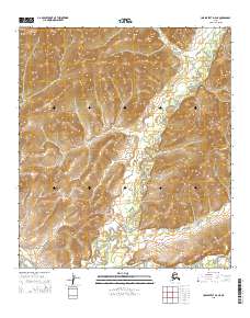
2015 Map of Unalakleet D-4 NE
USGS Topo · Published 2015About this map
The Nulato Hills dominate this portion of the Alaskan interior, where the North River winds through a complex valley system to its confluence with the Unalakleet River near the southern edge of the sheet. The landscape is defined by the drainage patterns of Powers Cr and Trail Cr, which cut through the high terrain between established township lines. Human activity is concentrated along a sparse network of service routes in the southern sections, including N River Road and Musk Ox Hill Rd. These paths likely supported local resource access or regional transit between the river valleys during this 2015 update. The map serves as a record of the remote topography before the Unalakleet reaches the Norton Bay coast.
Find a feature on this map
17 named features on this map. Tap any name to fly to it.
Don’t see what you’re looking for? This feature index may not catch every label — zoom into the map to look around manually.
Map Details
Editions of this 2015 Unalakleet D-4 NE Map
This is the sole edition of this map. No revisions or reprints were ever made.
Other maps of this area

1948 · Norton Bay
USGS Topo · 1:250,000

1950 · Unalakleet D-3
USGS Topo · 1:63,360

1950 · Norton Bay A-4
USGS Topo · 1:63,360

1950 · Norton Bay A-3
USGS Topo · 1:63,360

1950 · Unalakleet D-4
USGS Topo · 1:63,360

1951 · Unalakleet
USGS Topo · 1:250,000

1951 · Norton Bay
USGS Topo · 1:250,000

1952 · Unalakleet
USGS Topo · 1:250,000

1955 · Norton Bay
USGS Topo · 1:250,000

1964 · Unalakleet
USGS Topo · 1:250,000