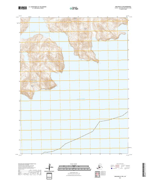
2021 Map of Unalaska B-1 NW
USGS Topo · Published 2021About this map
Unalaska Island and Sedanka Island dominate this maritime survey of the Fox Islands chain in the eastern Aleutian Islands. The terrain is defined by steep coastal elevations rising directly from the Pacific Ocean, with the narrow Udagak Strait separating the two landmasses. This passage provides a critical maritime corridor between the open ocean to the south and the sheltered waters of Udagak Bay to the north. At Passage Point, the geography highlights the complex shoreline and deep-water inlets typical of this volcanic archipelago. The map illustrates a landscape devoid of modern road infrastructure, emphasizing the isolation and maritime reliance of this subarctic region in the early twenty-first century.
Find a feature on this map
11 named features on this map. Tap any name to fly to it.
Don’t see what you’re looking for? This feature index may not catch every label — zoom into the map to look around manually.
Map Details
Editions of this 2021 Unalaska B-1 NW Map
This is the sole edition of this map. No revisions or reprints were ever made.
Other maps of this area

1951 · Unalaska
USGS Topo · 1:250,000
1989 · Unalaska B-1
USGS Topo · 1:63,360
1989 · Unalaska C-1
USGS Topo · 1:63,360

1989 · Unalaska B-2
USGS Topo · 1:63,360

1990 · Unalaska C-2
USGS Topo · 1:63,360
2020 · Unalaska B-1 NE
USGS Topo · 1:25,000
2020 · Unalaska B-2 SE
USGS Topo · 1:25,000
2021 · Unalaska C-2 SE
USGS Topo · 1:25,000
2021 · Unalaska C-1 SW
USGS Topo · 1:25,000
2021 · Unalaska C-1 SE
USGS Topo · 1:25,000