
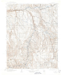
1911 Map of Uncompahgre
USGS Topo · Published 1911About this map
Lake City and the mining camps of the northern San Juan Mountains define this 1911 survey, a time when the region's economy relied heavily on high-altitude extraction and rail transport. The Denver and Rio Grande RR follows the Gunnison River and the depths of Black Canyon, connecting remote outposts like Sapinero and Lake Junction to the wider world. To the south, Capitol City sits near the headwaters of Henson Creek, while the Alpine Plateau and Cannibal Plateau overlook a landscape of scattered industry and commerce.
Find a feature on this map
95 named features on this map. Tap any name to fly to it.
Don’t see what you’re looking for? This feature index may not catch every label — zoom into the map to look around manually.
Map Details
Editions of this 1911 Uncompahgre Map
2 editions found
Other maps of this area

1897 · Silverton
USGS Topo · 1:62,500

1901 · Silverton
USGS Topo · 1:62,500

1902 · Silverton
USGS Topo · 1:62,500

1902 · Ouray
USGS Topo · 1:62,500

1903 · Lake City
USGS Topo · 1:62,500

1904 · Ouray
USGS Topo · 1:62,500

1905 · Lake City
USGS Topo · 1:62,500

1905 · San Cristobal
USGS Topo · 1:125,000

1907 · San Cristobal
USGS Topo · 1:125,000

1908 · Uncompahgre
USGS Topo · 1:125,000