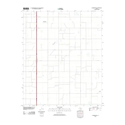
2010 Map of Underwood
USGS Topo · Published 2010About this map
Underwood and the nearby locale of Alley anchor this portion of Hale County, representing the quiet, rural character of the Texas Panhandle at the start of the 21st century. The landscape is defined by a rigorous grid of section roads, including Hi-Line Rd, Sun Rd, and Fm 37, which facilitate access to the surrounding agricultural and industrial lands. A notable natural feature is the ephemeral path of Crawfish Draw, which meanders across the geometric survey lines, while the Lutrick Oil Field in the southeast corner points to the region's long-standing reliance on petroleum extraction alongside its ranching and farming heritage. This map illustrates the intersection of intensive land management and the natural hydrology of the High Plains, where human habitation is sparse and infrastructure is primarily dedicated to the movement of commodities like oil and cattle.
Find a feature on this map
21 named features on this map. Tap any name to fly to it.
Don’t see what you’re looking for? This feature index may not catch every label — zoom into the map to look around manually.
Map Details
Editions of this 2010 Underwood Map
This is the sole edition of this map. No revisions or reprints were ever made.
Other maps of this area

1954 · Lubbock
USGS Topo · 1:250,000

1954 · Plainview
USGS Topo · 1:250,000

1957 · Abernathy
USGS Topo · 1:62,500

1958 · Plainview
USGS Topo · 1:250,000

1965 · Heckville
USGS Topo · 1:24,000

1968 · Happy Union
USGS Topo · 1:24,000

1968 · Julia Lake
USGS Topo · 1:24,000
1968 · Hale Center SW
USGS Topo · 1:24,000
1968 · Hale Center
USGS Topo · 1:24,000
1976 · Abernathy SE
USGS Topo · 1:24,000