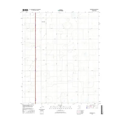
2016 Map of Underwood
USGS Topo · Published 2016About this map
Underwood sits at the heart of a vast agricultural landscape in the Texas Panhandle, positioned along a rigorous grid of section lines and rural thoroughfares. This 2016 survey illustrates the precision of modern land management, where the intersection of FM 37 and Hi-Line Rd anchors a network of county roads like Sun Rd and Nix Rd that serve the surrounding farmland. The presence of numerous depression-style wetlands across the terrain suggests a prairie-pothole landscape typical of the Llano Estacado, highlighting the subtle drainage patterns in this otherwise flat expanse.
Find a feature on this map
20 named features on this map. Tap any name to fly to it.
Don’t see what you’re looking for? This feature index may not catch every label — zoom into the map to look around manually.
Map Details
Editions of this 2016 Underwood Map
This is the sole edition of this map. No revisions or reprints were ever made.
Other maps of this area

1954 · Lubbock
USGS Topo · 1:250,000

1954 · Plainview
USGS Topo · 1:250,000

1957 · Abernathy
USGS Topo · 1:62,500

1958 · Plainview
USGS Topo · 1:250,000

1965 · Heckville
USGS Topo · 1:24,000

1968 · Happy Union
USGS Topo · 1:24,000

1968 · Julia Lake
USGS Topo · 1:24,000
1968 · Hale Center SW
USGS Topo · 1:24,000
1968 · Hale Center
USGS Topo · 1:24,000
1976 · Abernathy SE
USGS Topo · 1:24,000