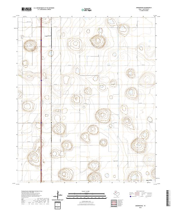
2022 Map of Underwood
USGS Topo · Published 2022About this map
Underwood sits within a geometric grid of rural roads and agricultural plots in this portion of the Texas High Plains. The landscape is defined by the rigid North-South orientation of thoroughfares like Hi-Line Rd, Nix Rd, and Sun Rd, which segment the terrain into precise sections. This systematic arrangement reflects the large-scale ranching and farming operations characteristic of Hale County. To the south, the map reaches the outskirts of Abernathy, while the primary transport corridor follows the path of Interstate 27. The area is dotted with numerous small basins and depressions, highlighting the local hydrology and the importance of land management in this semi-arid region. These features, along with farm-to-market roads like Fm 37 and Fm 54, illustrate the infrastructure required to support the local economy during the early 2020s.
Find a feature on this map
21 named features on this map. Tap any name to fly to it.
Don’t see what you’re looking for? This feature index may not catch every label — zoom into the map to look around manually.
Map Details
Editions of this 2022 Underwood Map
This is the sole edition of this map. No revisions or reprints were ever made.
Other maps of this area

1954 · Lubbock
USGS Topo · 1:250,000

1954 · Plainview
USGS Topo · 1:250,000

1957 · Abernathy
USGS Topo · 1:62,500

1958 · Plainview
USGS Topo · 1:250,000

1965 · Heckville
USGS Topo · 1:24,000

1968 · Happy Union
USGS Topo · 1:24,000

1968 · Julia Lake
USGS Topo · 1:24,000
1968 · Hale Center SW
USGS Topo · 1:24,000
1968 · Hale Center
USGS Topo · 1:24,000
1976 · Abernathy SE
USGS Topo · 1:24,000