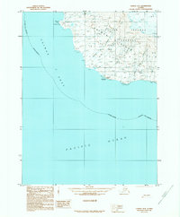
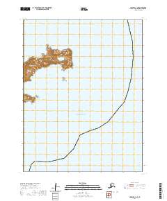
1989 Map of Unimak B-3
USGS Topo · Published 1989About this map
Aleutian Islands Wilderness dominates this coastal landscape along the southwestern edge of Unimak Island. The terrain is defined by dramatic coastal points and drainage systems flowing into the Pacific Ocean and Unimak Pass. Significant coastal markers like Sennett Point and Middle Point delineate the shoreline, while the inland area is carved by watercourses including Big River, Mishap Creek, and Iron Bridge Creek.
Find a feature on this map
15 named features on this map. Tap any name to fly to it.
Don’t see what you’re looking for? This feature index may not catch every label — zoom into the map to look around manually.
Map Details
Editions of this 1989 Unimak B-3 Map
This is the sole edition of this map. No revisions or reprints were ever made.
Other maps of this area

1951 · Unimak
USGS Topo · 1:250,000

1958 · Unimak
USGS Topo · 1:250,000
1989 · Unimak B-2
USGS Topo · 1:63,360
1989 · Unimak C-2
USGS Topo · 1:63,360
1989 · Unimak A-4
USGS Topo · 1:63,360
1989 · Unimak A-3
USGS Topo · 1:63,360
1989 · Unimak C-3
USGS Topo · 1:63,360
2020 · Unimak B-2 NW
USGS Topo · 1:25,000
2020 · Unimak A-4 NE
USGS Topo · 1:25,000
2020 · Unimak A-3 NE
USGS Topo · 1:25,000