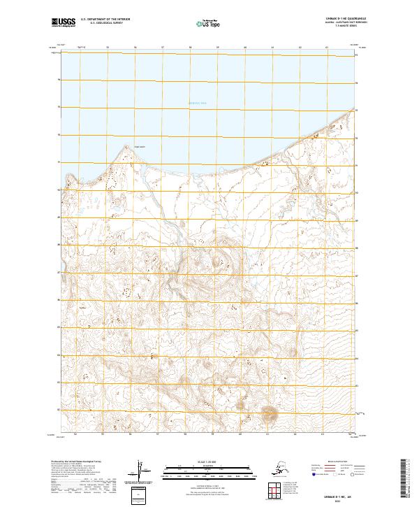
2021 Map of Unimak D-1 NE
USGS Topo · Published 2021About this map
Bering Sea waters wash against the northern coastline of Unimak Island in this coastal survey, where the prominent landform of Cape Lapin projects into the sea. The landscape is characterized by a complex network of coastal wetlands and drainage patterns that transition into the interior's rising elevation. This map provides a clear view of the island's maritime boundary before the terrain climbs toward the volcanic peaks of the Aleutian Range. The absence of roads or established settlements underscores the isolation of this portion of the Bering Sea coast, preserving a snapshot of the geographic interface between the Alaskan tundra and the sea.
Find a feature on this map
6 named features on this map. Tap any name to fly to it.
Don’t see what you’re looking for? This feature index may not catch every label — zoom into the map to look around manually.
Map Details
Editions of this 2021 Unimak D-1 NE Map
This is the sole edition of this map. No revisions or reprints were ever made.
Other maps of this area

1943 · Fort Randall
USGS Topo · 1:250,000

1949 · False Pass
USGS Topo · 1:250,000

1949 · Fort Randall
USGS Topo · 1:250,000

1950 · False Pass
USGS Topo · 1:250,000

1950 · Fort Randall
USGS Topo · 1:250,000

1951 · Unimak
USGS Topo · 1:250,000

1958 · Unimak
USGS Topo · 1:250,000
1989 · Unimak D-1
USGS Topo · 1:63,360
1989 · Cold Bay A-6
USGS Topo · 1:63,360
1989 · False Pass D-6
USGS Topo · 1:63,360