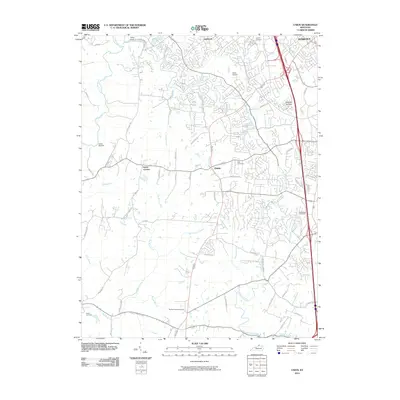
2010 Map of Union
USGS Topo · Published 2010About this map
Union and the surrounding Boone County landscape appear here during a period of significant suburban expansion, evidenced by the dense residential street networks of Oakbrook and the developing outskirts of Florence. Despite this growth, the map preserves the traditional rural framework of the region, anchored by historical family and church burial grounds such as Hopeful Cemetery, Rice Cemetery, and Hughes Chapel Cemetery. The terrain is deeply incised by a complex drainage system, where the South Fork Gunpowder Creek and Big Bone Creek have shaped the placement of early routes like Rice Pike and Big Bone Rd. Modern recreational and transport hubs, including the Kentucky Raceway and Estes Airport, sit adjacent to older community nodes like Hueys Corners, illustrating the layering of twenty-first-century infrastructure over a much older agricultural and pioneer settlement pattern.
Find a feature on this map
58 named features on this map. Tap any name to fly to it.
Don’t see what you’re looking for? This feature index may not catch every label — zoom into the map to look around manually.
Map Details
Editions of this 2010 Union Map
This is the sole edition of this map. No revisions or reprints were ever made.
Other maps of this area

1914 · West Cincinnati
USGS Topo · 1:62,500

1915 · Lawrenceburg
USGS Topo · 1:48,000

1928 · Lawrenceburg
USGS Topo · 1:62,500

1932 · Lawrenceburg
USGS Topo · 1:62,500

1943 · Rising Sun
USGS Topo · 1:24,000

1943 · Lawrenceburg
USGS Topo · 1:24,000

1943 · Patriot
USGS Topo · 1:24,000

1950 · Union
USGS Topo · 1:24,000

1950 · Independence
USGS Topo · 1:24,000

1950 · Verona
USGS Topo · 1:24,000