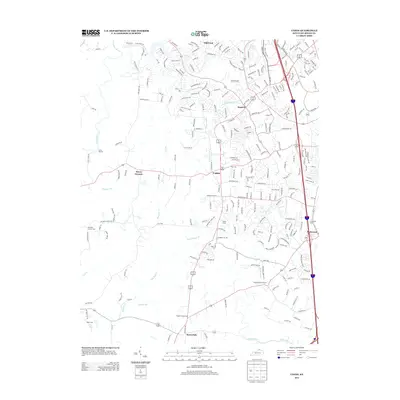
2013 Map of Union
USGS Topo · Published 2013About this map
Union and the surrounding Boone County landscape exhibit a blend of suburban expansion and traditional Kentucky crossroads in the early 21st century. The map highlights several smaller settlements such as Oakbrook, Sugartit, and Beaverlick, which provide important geographic anchors for local historians. This era is characterized by an intricate network of residential streets branching off established routes like Camp Ernst Rd, while the southern and western portions of the sheet retain a more dispersed, creek-carved character. The area is notable for its numerous burial grounds, including the Big Bone Church Cem and Richwood Church Cem, which serve as vital points for genealogical research. Watercourses such as Fowlers Fork and Big Bone Cr snake through the terrain, defining the drainage patterns that shaped early land use before the modern sprawl reached north toward Estes Airport.
Find a feature on this map
257 named features on this map. Tap any name to fly to it.
Don’t see what you’re looking for? This feature index may not catch every label — zoom into the map to look around manually.
Map Details
Editions of this 2013 Union Map
This is the sole edition of this map. No revisions or reprints were ever made.
Other maps of this area

1914 · West Cincinnati
USGS Topo · 1:62,500

1915 · Lawrenceburg
USGS Topo · 1:48,000

1928 · Lawrenceburg
USGS Topo · 1:62,500

1932 · Lawrenceburg
USGS Topo · 1:62,500

1943 · Rising Sun
USGS Topo · 1:24,000

1943 · Lawrenceburg
USGS Topo · 1:24,000

1943 · Patriot
USGS Topo · 1:24,000

1950 · Union
USGS Topo · 1:24,000

1950 · Independence
USGS Topo · 1:24,000

1950 · Verona
USGS Topo · 1:24,000