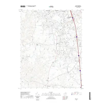
2019 Map of Union
USGS Topo · Published 2019About this map
Florence and Union anchor this 2019 study of Northern Kentucky's rolling landscape, where the expanding suburban footprint meets deep-seated rural foundations. The map reveals a high concentration of family and community burial grounds, including the Hopeful Cem and Big Bone Church Cem, which serve as vital landmarks for local genealogists. These historic sites are interspersed among modern developments like Hopeful Heights and Oakbrook, illustrating the shift from agricultural roots to a regional residential hub.
Find a feature on this map
198 named features on this map. Tap any name to fly to it.
Don’t see what you’re looking for? This feature index may not catch every label — zoom into the map to look around manually.
Map Details
Editions of this 2019 Union Map
This is the sole edition of this map. No revisions or reprints were ever made.
Other maps of this area

1914 · West Cincinnati
USGS Topo · 1:62,500

1915 · Lawrenceburg
USGS Topo · 1:48,000

1928 · Lawrenceburg
USGS Topo · 1:62,500

1932 · Lawrenceburg
USGS Topo · 1:62,500

1943 · Rising Sun
USGS Topo · 1:24,000

1943 · Lawrenceburg
USGS Topo · 1:24,000

1943 · Patriot
USGS Topo · 1:24,000

1950 · Union
USGS Topo · 1:24,000

1950 · Independence
USGS Topo · 1:24,000

1950 · Verona
USGS Topo · 1:24,000