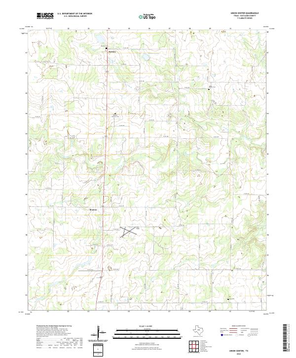
2022 Map of Union Center
USGS Topo · Published 2022About this map
The small rural communities of Romney and Branton anchor this pocket of Eastland County, where the landscape is defined by the winding course of the Sabana River and its various tributaries. The region is dotted with historic markers of family and faith, including the Romney Lutheran Cem and Long Branch Cem. These sites, along with the Elm Cem and Romney Cem, offer significant clues for genealogists tracking early settlers in this part of north-central Texas. The map also captures the local hydrography, showing Yellow Br, Long Br, and the Elm Cr drainage system. Beyond the residential clusters, the land is marked by an Oil Gas Lease area and the Star Field landing strip, reflecting the region's intersection of ranching, energy production, and rural utility.
Find a feature on this map
53 named features on this map. Tap any name to fly to it.
Don’t see what you’re looking for? This feature index may not catch every label — zoom into the map to look around manually.
Map Details
Editions of this 2022 Union Center Map
This is the sole edition of this map. No revisions or reprints were ever made.
Other maps of this area

1894 · Eastland
USGS Topo · 1:125,000

1931 · Baird
USGS Topo · 1:125,000

1932 · Baird
USGS Topo · 1:125,000

1954 · Abilene
USGS Topo · 1:250,000

1958 · Abilene
USGS Topo · 1:250,000

1966 · Sipe Springs
USGS Topo · 1:24,000
1966 · Rising Star
USGS Topo · 1:24,000

1966 · Carbon
USGS Topo · 1:24,000

1966 · Scranton
USGS Topo · 1:24,000

1966 · Cisco South
USGS Topo · 1:24,000