
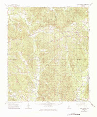
1963 Map of Union Church
USGS Topo · Published 1964About this map
The Homochitto River and its intricate drainage network define this 1963 landscape, where the Mississippi Central rail line cuts through the southern reaches of the Homochitto National Forest. The map documents a deeply rooted rural society across the Jefferson and Franklin county line, centered on settlements like Union Church and Oldenburg. The survey reveals a high density of small community centers, marked by numerous local landmarks such as Ephesus Ch, Knight Sch, and the Mt Moriah Ch.
Find a feature on this map
93 named features on this map. Tap any name to fly to it.
Don’t see what you’re looking for? This feature index may not catch every label — zoom into the map to look around manually.
Map Details
Editions of this 1963 Union Church Map
2 editions found
Other maps of this area

1939 · Lorman
USGS Topo · 1:62,500

1953 · Natchez
USGS Topo · 1:250,000

1956 · Natchez
USGS Topo · 1:250,000

1958 · St. Joseph
USGS Topo · 1:62,500

1959 · Natchez
USGS Topo · 1:250,000

1961 · Crosby
USGS Topo · 1:62,500

1962 · Fayette
USGS Topo · 1:62,500

1962 · Bude
USGS Topo · 1:62,500

1963 · Red Lick
USGS Topo · 1:24,000

1963 · McBride
USGS Topo · 1:24,000