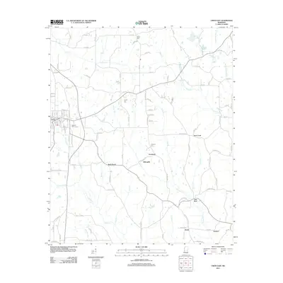
2012 Map of Union East
USGS Topo · Published 2012About this map
The town of Union serves as the western anchor for this landscape, where the street grid of the eastern village gives way to a network of winding county roads and small agricultural settlements. The terrain is defined by the drainage systems of Chunky Cr and Fulton Cr, which carve through the countryside toward smaller communities like Greenland and Rock Branch. This 2012 survey illustrates the enduring rural character of the area, punctuated by historic burying grounds including Cross Roads Cem and County Line Cem. These landmarks, along with established localities such as Little Rock and Beulah, reveal a pattern of settlement tied to the local watercourses and the intersections of long-standing routes like Old Decatur Rd. In Union, Memorial Park stands near the central streets, marking the developed heart of a quadrangle otherwise dominated by timber and farmland.
Find a feature on this map
112 named features on this map. Tap any name to fly to it.
Don’t see what you’re looking for? This feature index may not catch every label — zoom into the map to look around manually.
Map Details
Editions of this 2012 Union East Map
This is the sole edition of this map. No revisions or reprints were ever made.
Other maps of this area

1953 · Meridian
USGS Topo · 1:250,000

1957 · Meridian
USGS Topo · 1:250,000

1957 · Chunky
USGS Topo · 1:62,500

1962 · House
USGS Topo · 1:24,000

1962 · Post
USGS Topo · 1:24,000

1965 · Meridian
USGS Topo · 1:250,000

1966 · Decatur NW
USGS Topo · 1:24,000

1966 · Decatur
USGS Topo · 1:24,000

1972 · Deemer
USGS Topo · 1:24,000

1972 · Union East
USGS Topo · 1:24,000