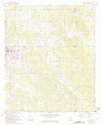
1972 Map of Union East
USGS Topo · Published 1982About this map
The town of Union serves as the hub for this Mississippi landscape, positioned where the Neshoba and Newton county line meets a significant rail junction. Two major railroads, the Gulf Mobile and Ohio and the Illinois Central Gulf, intersect here, defining the town’s development and industrial reach near Memorial Park. Beyond the rail corridors, the terrain transitions into a patchwork of rural settlements and agricultural fields drained by numerous waterways, including Fulton Creek and Double Reed Brake.
Find a feature on this map
37 named features on this map. Tap any name to fly to it.
Don’t see what you’re looking for? This feature index may not catch every label — zoom into the map to look around manually.
Map Details
Editions of this 1972 Union East Map
2 editions found
Other maps of this area

1953 · Meridian
USGS Topo · 1:250,000

1957 · Meridian
USGS Topo · 1:250,000

1957 · Chunky
USGS Topo · 1:62,500

1962 · House
USGS Topo · 1:24,000

1962 · Post
USGS Topo · 1:24,000

1965 · Meridian
USGS Topo · 1:250,000

1966 · Decatur NW
USGS Topo · 1:24,000

1966 · Decatur
USGS Topo · 1:24,000

1972 · Deemer
USGS Topo · 1:24,000

1972 · Union East
USGS Topo · 1:24,000