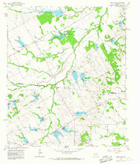
1965 Map of Union High
USGS Topo · Published 1967About this map
Union High and the surrounding rural landscapes of Navarro and Limestone counties are captured here during a period of significant hydrological management. The terrain is defined by an extensive network of flood-control structures, including Dam No 15 and Dam No 26A, which create several areas of controlled inundation along Board Creek and its tributaries. These earthen works reflect the mid-century agricultural priorities of the region, designed to mitigate the erosion and flooding of the blackland prairies.
Find a feature on this map
34 named features on this map. Tap any name to fly to it.
Don’t see what you’re looking for? This feature index may not catch every label — zoom into the map to look around manually.
Map Details
Editions of this 1965 Union High Map
This is the sole edition of this map. No revisions or reprints were ever made.
Other maps of this area

1920 · Mexia
USGS Topo · 1:62,500

1954 · Waco
USGS Topo · 1:250,000

1955 · Waco
USGS Topo · 1:250,000

1956 · Dawson
USGS Topo · 1:24,000

1957 · Groesbeck
USGS Topo · 1:62,500

1960 · Echols
USGS Topo · 1:24,000

1960 · Tehuacana
USGS Topo · 1:24,000

1963 · Richland
USGS Topo · 1:24,000

1963 · Wortham
USGS Topo · 1:24,000

1963 · Mexia
USGS Topo · 1:24,000