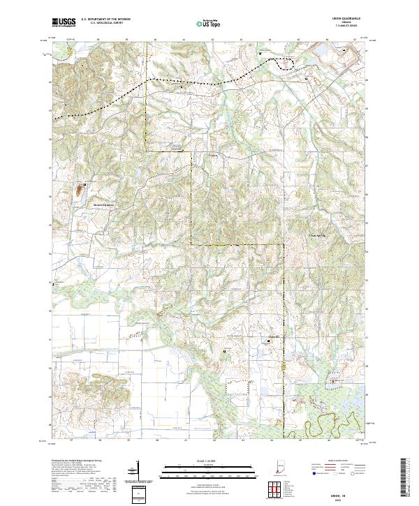
2022 Map of Union
USGS Topo · Published 2022About this map
The Patoka River and its complex network of tributaries like Houchins Ditch and Morrow Lateral define the landscape of south-central Indiana at the meeting point of Gibson and Pike counties. Smaller settlements such as Union, Mount Olympus, and Oatsville serve as local anchors in an area dominated by rural road grids and significant water bodies. Genealogists will find a wealth of burial records across the landscape, from the Independent Order of Odd Fellows Cem near the northern border to the Kirk-McRoberts Cem and Phillips Cem further west. The terrain transitions from the broader flats near the White River in the northwest to the more intricate drainage basins of Indian Cr and Yellow Cr. This survey documents a quiet rural economy where longstanding family names and community landmarks, like Coats Spring, remain deeply integrated with the natural hydrography of the region.
Find a feature on this map
98 named features on this map. Tap any name to fly to it.
Don’t see what you’re looking for? This feature index may not catch every label — zoom into the map to look around manually.
Map Details
Editions of this 2022 Union Map
This is the sole edition of this map. No revisions or reprints were ever made.
Other maps of this area

1901 · Princeton
USGS Topo · 1:62,500

1902 · Ditney
USGS Topo · 1:125,000

1903 · Petersburg
USGS Topo · 1:62,500

1903 · Princeton
USGS Topo · 1:62,500

1903 · Patoka
USGS Topo · 1:125,000

1915 · Vincennes
USGS Topo · 1:62,500

1944 · Monroe City
USGS Topo · 1:24,000

1944 · Iona
USGS Topo · 1:24,000

1944 · Vincennes
USGS Topo · 1:62,500

1956 · Vincennes
USGS Topo · 1:250,000