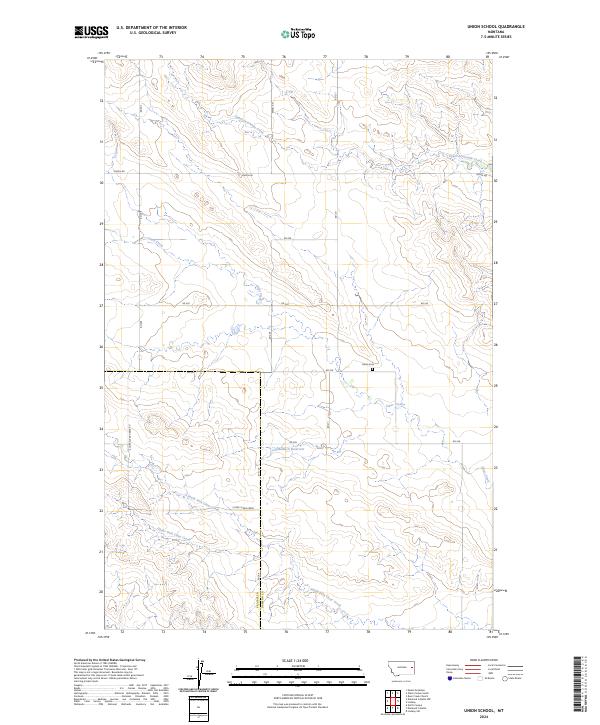
2024 Map of Union School
USGS Topo · Published 2024About this map
Union Cem sits as a quiet anchor in this high plains landscape on the border of Prairie and Dawson counties. This eastern Montana terrain is defined by an intricate network of seasonal drainage and local water management, centered on the Clear Creek system. The map details the branching paths of Upper Sevenmile Creek and the South Fork Clear Creek, which carve through the land alongside human-made improvements like Malkuch Reservoir.
Find a feature on this map
20 named features on this map. Tap any name to fly to it.
Don’t see what you’re looking for? This feature index may not catch every label — zoom into the map to look around manually.
Map Details
Editions of this 2024 Union School Map
This is the sole edition of this map. No revisions or reprints were ever made.
Other maps of this area

1954 · Glendive
USGS Topo · 1:250,000

1957 · Glendive
USGS Topo · 1:250,000

1958 · Glendive
USGS Topo · 1:250,000

1982 · Circle
USGS Topo · 1:100,000
1983 · Union School
USGS Topo · 1:24,000
1983 · Lindsay SW
USGS Topo · 1:24,000
1983 · North Coulee
USGS Topo · 1:24,000

1983 · Olson Coulee South
USGS Topo · 1:24,000

1983 · Mount Antelope
USGS Topo · 1:24,000

1983 · Deer Creek Church
USGS Topo · 1:24,000