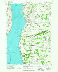
1955 Map of Union Springs
USGS Topo · Published 1967About this map
Union Springs sits along the eastern shore of Cayuga Lake, serving as a central hub for the surrounding agricultural landscape of Springport and Ledyard. The shoreline is marked by prominent landmarks including Frontenac Island and Hibiscus Pt, while the Lehigh Valley railroad corridor traces the water's edge, connecting lakeside settlements like Levanna and Aurora. Inland, the terrain is defined by the deep incision of Great Gully and a network of rural crossroads such as Cooneys Corners and Barbers Corners. The map documents established local institutions like the Union Springs Academy and several houses of worship, including St Micheals Ch. Genealogists will find numerous burial sites noted, including the Old Quaker Cem and Oak Glen Cem, reflecting the area's long-standing Quaker and pioneer heritage.
Find a feature on this map
75 named features on this map. Tap any name to fly to it.
Don’t see what you’re looking for? This feature index may not catch every label — zoom into the map to look around manually.
Map Details
Editions of this 1955 Union Springs Map
Other maps of this area

1899 · Auburn
USGS Topo · 1:62,500

1902 · Geneva
USGS Topo · 1:62,500

1902 · Genoa
USGS Topo · 1:62,500

1902 · Ovid
USGS Topo · 1:62,500

1902 · Auburn
USGS Topo · 1:62,500

1942 · Ovid
USGS Topo · 1:31,680

1942 · Sheldrake
USGS Topo · 1:24,000

1942 · Genoa
USGS Topo · 1:24,000
1943 · Genoa
USGS Topo · 1:31,680

1943 · Cayuga
USGS Topo · 1:31,680