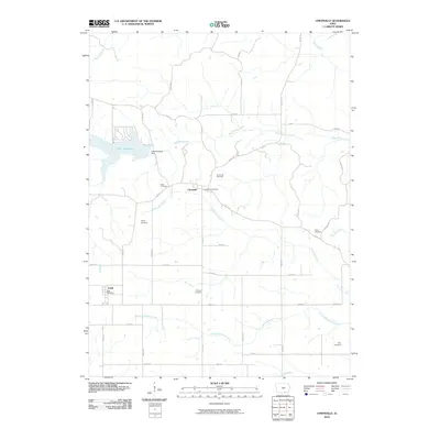
2010 Map of Unionville
USGS Topo · Published 2010About this map
Unionville and Udell serve as the primary hubs in this southern Iowa landscape, where agricultural land is segmented by an extensive grid of country roads. The northern portion of the map is dominated by the waters of Lake Sundown, held by the Lake Sundown Dam. This man-made reservoir provides a sharp contrast to the natural drainage patterns of South Soap Creek and Buzzard Creek to the north.
Find a feature on this map
47 named features on this map. Tap any name to fly to it.
Don’t see what you’re looking for? This feature index may not catch every label — zoom into the map to look around manually.
Map Details
Editions of this 2010 Unionville Map
This is the sole edition of this map. No revisions or reprints were ever made.
Other maps of this area

1939 · Centerville
USGS Topo · 1:62,500

1939 · Mystic
USGS Topo · 1:62,500

1941 · Centerville
USGS Topo · 1:62,500

1942 · Mystic
USGS Topo · 1:62,500

1954 · Centerville
USGS Topo · 1:250,000

1957 · Centerville
USGS Topo · 1:250,000

1958 · Centerville
USGS Topo · 1:250,000

1966 · Hiattsville
USGS Topo · 1:24,000
1968 · Blakesburg NE
USGS Topo · 1:24,000

1968 · Unionville
USGS Topo · 1:24,000