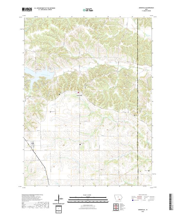
2022 Map of Unionville
USGS Topo · Published 2022About this map
The Iowa-Missouri borderlands character is defined by a dense network of watercourses, including South Soap Creek, N Fox Cr, and the Center Br Fox River. Centered on the town of Unionville, the landscape is a grid of county roads that navigate the varying elevations between these creek beds. To the west, Udell serves as another focal point for local settlement. Genealogists will find significant value in the distribution of family and community burial sites, such as Eaton Cem and Taylor Cem, which are tucked away near the borders of Appanoose and Davis Counties. The northern portion of the map is dominated by Lake Sundown, a significant reservoir surrounded by newer residential developments like Westview Dr and Hickory Ridge Ln, contrasting with the more traditional rural patterns of the southern townships.
Find a feature on this map
68 named features on this map. Tap any name to fly to it.
Don’t see what you’re looking for? This feature index may not catch every label — zoom into the map to look around manually.
Map Details
Editions of this 2022 Unionville Map
This is the sole edition of this map. No revisions or reprints were ever made.
Other maps of this area

1939 · Centerville
USGS Topo · 1:62,500

1939 · Mystic
USGS Topo · 1:62,500

1941 · Centerville
USGS Topo · 1:62,500

1942 · Mystic
USGS Topo · 1:62,500

1954 · Centerville
USGS Topo · 1:250,000

1957 · Centerville
USGS Topo · 1:250,000

1958 · Centerville
USGS Topo · 1:250,000

1966 · Hiattsville
USGS Topo · 1:24,000
1968 · Blakesburg NE
USGS Topo · 1:24,000

1968 · Unionville
USGS Topo · 1:24,000