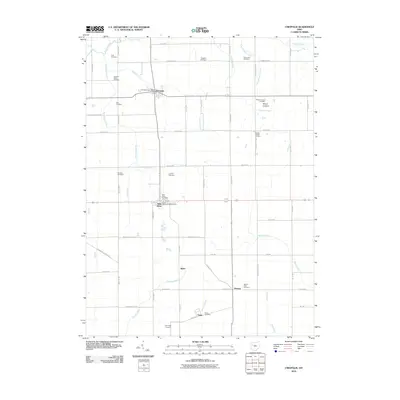
2010 Map of Uniopolis
USGS Topo · Published 2010About this map
Uniopolis and Saint Johns serve as the primary hubs in this portion of Auglaize County, connected by a network of historic pikes and rural roads. The landscape is defined by its agricultural character and a dense concentration of family and community burial grounds, such as Vaughan Cemetery and Reinhart Cemetery, which offer significant value for genealogical research. Numerous small waterways, including Blackhoof Creek, Huffman Creek, and Pusheta Creek, drainage the terrain, influencing the placement of early settlements like Slater and Geyer. The map also identifies Mount Lookout, a distinct topographical feature overlooking Virginia Creek. The presence of the Uniopolis Post Office and Saint Johns Post Office highlights the civic importance of these villages during this era of rural Ohio history.
Find a feature on this map
57 named features on this map. Tap any name to fly to it.
Don’t see what you’re looking for? This feature index may not catch every label — zoom into the map to look around manually.
Map Details
Editions of this 2010 Uniopolis Map
This is the sole edition of this map. No revisions or reprints were ever made.
Other maps of this area

1906 · Lima
USGS Topo · 1:62,500

1913 · Alger
USGS Topo · 1:48,000

1913 · Bellefontaine
USGS Topo · 1:48,000

1913 · Sidney
USGS Topo · 1:62,500

1915 · Alger
USGS Topo · 1:62,500

1915 · Bellefontaine
USGS Topo · 1:62,500

1943 · Alger
USGS Topo · 1:62,500

1944 · Sidney
USGS Topo · 1:62,500

1944 · Bellefontaine
USGS Topo · 1:62,500

1950 · Marion
USGS Topo · 1:250,000