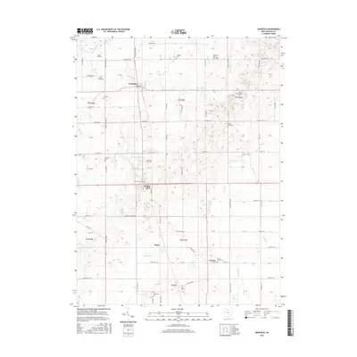
2016 Map of Uniopolis
USGS Topo · Published 2016About this map
Uniopolis and Saint Johns anchor this rural landscape in eastern Auglaize County, where a dense network of country roads connects scattered hamlets and family burial grounds. The terrain is defined by the headwaters of several drainages, including Huffman Cr and Blackhoof Cr which flow toward the Auglaize River in the northwest corner. Genealogists will find a wealth of named cemeteries such as Vaughan Cem, Geyer Cem, and Helminger Cem tucked away near local crossroads and farmsteads. To the east, the elevation rises toward Mt Lookout, overlooking the winding path of Virginia Cr. The map captures the enduring agricultural character of the region, where places like Slater, Gutman, and Geyer persist as quiet landmarks along the township and county lines, reflecting generations of settlement between Pusheta Cr and the upper reaches of Wolf Cr.
Find a feature on this map
39 named features on this map. Tap any name to fly to it.
Don’t see what you’re looking for? This feature index may not catch every label — zoom into the map to look around manually.
Map Details
Editions of this 2016 Uniopolis Map
This is the sole edition of this map. No revisions or reprints were ever made.
Other maps of this area

1906 · Lima
USGS Topo · 1:62,500

1913 · Alger
USGS Topo · 1:48,000

1913 · Bellefontaine
USGS Topo · 1:48,000

1913 · Sidney
USGS Topo · 1:62,500

1915 · Alger
USGS Topo · 1:62,500

1915 · Bellefontaine
USGS Topo · 1:62,500

1943 · Alger
USGS Topo · 1:62,500

1944 · Sidney
USGS Topo · 1:62,500

1944 · Bellefontaine
USGS Topo · 1:62,500

1950 · Marion
USGS Topo · 1:250,000