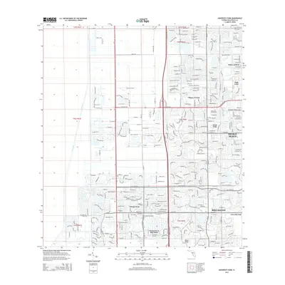
2015 Map of University Park
USGS Topo · Published 2015About this map
University Park and the burgeoning residential communities west of Boca Raton and Delray Beach are the primary focus of this 2015 U.S. Geological Survey study. The landscape is defined by the rigid geometry of residential developments and planned water management systems, notably the L-40 Canal that borders the marshlands to the west. The area shows a highly organized suburban pattern with gated communities and complexes such as Hamptons at Boca Raton, Whisper Walk, and Kings Point.
Find a feature on this map
50 named features on this map. Tap any name to fly to it.
Don’t see what you’re looking for? This feature index may not catch every label — zoom into the map to look around manually.
Map Details
Editions of this 2015 University Park Map
This is the sole edition of this map. No revisions or reprints were ever made.
Other maps of this area

1945 · Greenacres City
USGS Topo · 1:24,000

1945 · Lake Worth
USGS Topo · 1:24,000

1946 · West Dixie Bend
USGS Topo · 1:24,000

1946 · Boca Raton
USGS Topo · 1:24,000

1947 · Delmar Farms
USGS Topo · 1:24,000

1949 · Lake Worth
USGS Topo · 1:24,000

1949 · West Dixie Bend
USGS Topo · 1:24,000

1949 · Delmar Farms
USGS Topo · 1:24,000

1950 · Boca Raton
USGS Topo · 1:24,000

1950 · Delray Beach
USGS Topo · 1:24,000
Featured Places
- Boca Raton, FL
- Delray Beach, FL
- Villages of Oriole, FL
- Brentwood of Boca Raton, FL
- Century Village Boca Raton, FL