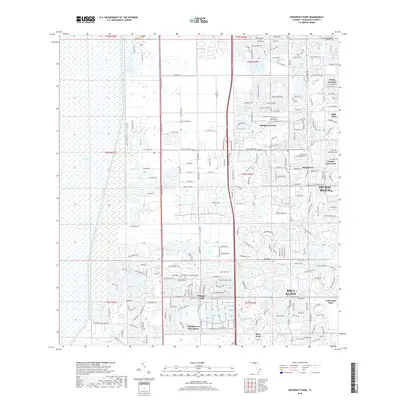
2018 Map of University Park
USGS Topo · Published 2018About this map
The Everglades dominates the western edge of this landscape, where the Marsh Trail and Old Everglades Pump Rd transition into a highly structured suburban environment. This 2018 survey reveals a specialized pattern of residential development in southern Palm Beach County, characterized by massive planned communities and gated enclaves. Significant named residential areas include Hamptons at Boca Raton, Whisper Walk, and Boca West, each defined by complex road networks and integrated water features. The eastern portion of the map is densely built, with specific landmarks like the Antiquers Aerodrome serving the local aviation community. The presence of the L-30 Canal and L-31 Canal underscores the managed hydrology required to sustain this metropolitan expansion at the very edge of the Florida wetlands.
Find a feature on this map
131 named features on this map. Tap any name to fly to it.
Don’t see what you’re looking for? This feature index may not catch every label — zoom into the map to look around manually.
Map Details
Editions of this 2018 University Park Map
This is the sole edition of this map. No revisions or reprints were ever made.
Other maps of this area

1945 · Greenacres City
USGS Topo · 1:24,000

1945 · Lake Worth
USGS Topo · 1:24,000

1946 · West Dixie Bend
USGS Topo · 1:24,000

1946 · Boca Raton
USGS Topo · 1:24,000

1947 · Delmar Farms
USGS Topo · 1:24,000

1949 · Lake Worth
USGS Topo · 1:24,000

1949 · West Dixie Bend
USGS Topo · 1:24,000

1949 · Delmar Farms
USGS Topo · 1:24,000

1950 · Boca Raton
USGS Topo · 1:24,000

1950 · Delray Beach
USGS Topo · 1:24,000
Featured Places
- Boca Raton, FL
- Delray Beach, FL
- Villages of Oriole, FL
- Brentwood of Boca Raton, FL
- Century Village Boca Raton, FL