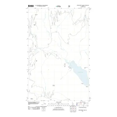
2011 Map of Upper Priest Lake
USGS Topo · Published 2011About this map
Upper Priest Lake and its surrounding Selkirk Mountain terrain define this northern Idaho landscape, where the Upper Priest River flows through a deep drainage before entering the lake's northern reach. The area remains focused on recreation and resource history, evidenced by the preservation of the Upper Priest Lake Scenic Area and several remote campsites. The mapping of the Mountain Chief Mine, Plowboy Mine, and Navigation Mine indicates a legacy of mineral exploration along the western and southern slopes above the water. Access to these steep ridges is provided by a network of forest roads like Gold Creek Rd and Quartz Crystals Rd, leading to high-elevation points such as Gold Peak and the Hughes Ridge Viewpoint.
Find a feature on this map
26 named features on this map. Tap any name to fly to it.
Don’t see what you’re looking for? This feature index may not catch every label — zoom into the map to look around manually.
Map Details
Editions of this 2011 Upper Priest Lake Map
This is the sole edition of this map. No revisions or reprints were ever made.
Other maps of this area

1911 · Priest Lake
USGS Topo · 1:250,000

1913 · Priest Lake
USGS Topo · 1:250,000

1934 · Metaline
USGS Topo · 1:125,000

1942 · Metaline
USGS Topo · 1:125,000

1958 · Sandpoint
USGS Topo · 1:250,000

1963 · Sandpoint
USGS Topo · 1:250,000

1967 · Priest Lake NE
USGS Topo · 1:24,000

1967 · Salmo Mtn.
USGS Topo · 1:24,000

1967 · Priest Lake NW
USGS Topo · 1:24,000

1967 · Helmer Mtn
USGS Topo · 1:24,000