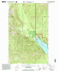
1996 Map of Upper Priest Lake
USGS Topo · Published 1999About this map
Upper Priest Lake dominates this northern Idaho landscape, sheltered within the Kaniksu National Forest and the Priest Lake State Forest. The map documents a rugged wilderness setting where industrial history and conservation meet, specifically within the Upper Priest Lake Scenic Area. Resource extraction is evident through several named sites near the shoreline, including the Plowboy Mine, Mountain Chief Mine, and a designated Prospect on the eastern slopes of Plowboy Mountain. To the west, the terrain rises toward Hughes Ridge, which features the Hughes Meadows Lookout Station and the Hughes Ridge Viewpoint. Drainage patterns are clearly defined by the Upper Priest River and its tributaries, such as Ruby Creek and Hughes Fork, which flow through deep glacial valleys. The boundary between Boundary and Bonner Counties bisects the northern half of the sheet, marking a significant administrative division in this high-elevation backcountry.
Find a feature on this map
23 named features on this map. Tap any name to fly to it.
Don’t see what you’re looking for? This feature index may not catch every label — zoom into the map to look around manually.
Map Details
Editions of this 1996 Upper Priest Lake Map
This is the sole edition of this map. No revisions or reprints were ever made.
Other maps of this area

1911 · Priest Lake
USGS Topo · 1:250,000

1913 · Priest Lake
USGS Topo · 1:250,000

1934 · Metaline
USGS Topo · 1:125,000

1942 · Metaline
USGS Topo · 1:125,000

1958 · Sandpoint
USGS Topo · 1:250,000

1963 · Sandpoint
USGS Topo · 1:250,000

1967 · Priest Lake NE
USGS Topo · 1:24,000

1967 · Salmo Mtn.
USGS Topo · 1:24,000

1967 · Priest Lake NW
USGS Topo · 1:24,000

1967 · Helmer Mtn
USGS Topo · 1:24,000