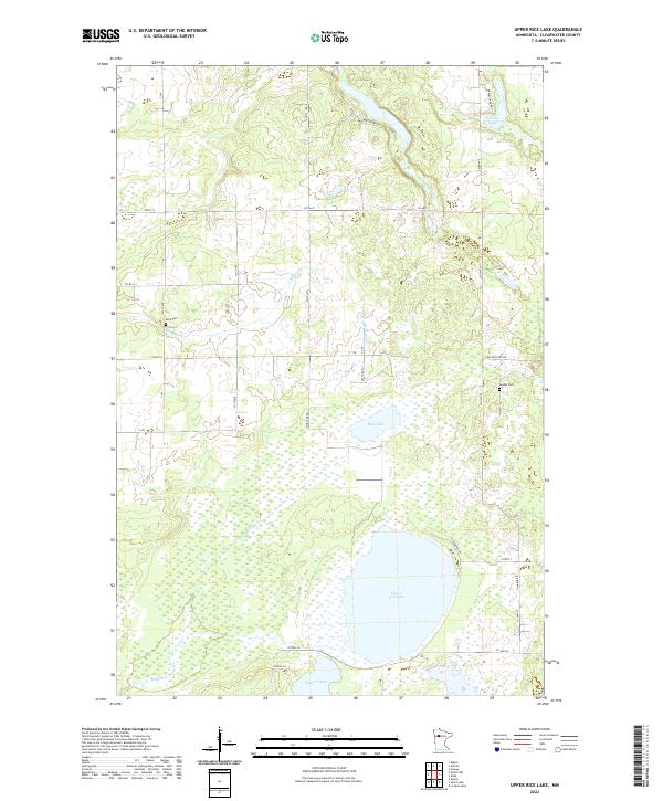
2022 Map of Upper Rice Lake
USGS Topo · Published 2022About this map
Upper Rice Lake and its surrounding wetlands form the center of this Clearwater County landscape, which transitions between large open waters and dense marshlands. The Wild Rice River meanders through the western and southern sections of the terrain, joined by smaller tributaries like Mosquito Cr. This region maintains a traditional rural character, with scattered family sites and early burial grounds such as Nora Cem and Lundin Cem preserved among the farms and woods. The network of local routes, including Co Hwy 13 and 320th St, navigates around the numerous water bodies like Daniel Lake and Minerva Lake, reflecting a long-standing balance between human transit and the natural drainage of the Minnesota lake country.
Find a feature on this map
37 named features on this map. Tap any name to fly to it.
Don’t see what you’re looking for? This feature index may not catch every label — zoom into the map to look around manually.
Map Details
Editions of this 2022 Upper Rice Lake Map
This is the sole edition of this map. No revisions or reprints were ever made.
Other maps of this area

1919 · Solway
USGS Topo · 1:62,500

1943 · Solway
USGS Topo · 1:62,500

1943 · Bagley
USGS Topo · 1:62,500

1954 · Bemidji
USGS Topo · 1:250,000

1957 · Bemidji
USGS Topo · 1:250,000

1958 · Bemidji
USGS Topo · 1:250,000
1969 · Bagley
USGS Topo · 1:24,000

1969 · Shevlin
USGS Topo · 1:24,000
1969 · Zerkel
USGS Topo · 1:24,000

1969 · Heart Lake
USGS Topo · 1:24,000