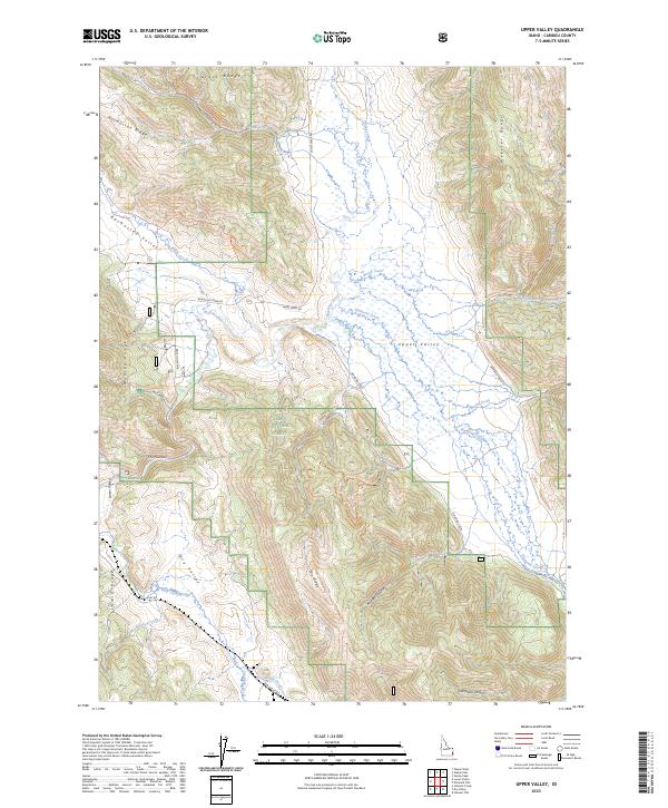
2023 Map of Upper Valley
USGS Topo · Published 2023About this map
The Caribou National Forest dominates this landscape of southeastern Idaho, where high mountain ridges and deep creek valleys define the local geography. Significant drainages such as the Blackfoot River and Diamond Creek cut through the terrain, illustrating the hydrologic network that supports the region's wilderness. Parallel geological features like Rasmussen Ridge and the Webster Range create a corrugated landform, with Rasmussen Valley and Dry Valley providing key lowlands between the peaks. The presence of The Narrows along the Blackfoot River highlights a point of geographical constriction, while historical and modern transportation routes like Lanes Creek Rd and Diamond Creek Rd follow the natural contours of the land, connecting the various canyons and flats that characterize this part of Caribou County.
Find a feature on this map
39 named features on this map. Tap any name to fly to it.
Don’t see what you’re looking for? This feature index may not catch every label — zoom into the map to look around manually.
Map Details
Editions of this 2023 Upper Valley Map
This is the sole edition of this map. No revisions or reprints were ever made.
Other maps of this area

1911 · Slug Creek
USGS Topo · 1:62,500

1915 · Freedom
USGS Topo · 1:62,500

1915 · Crow Creek
USGS Topo · 1:62,500

1915 · Lanes Creek
USGS Topo · 1:62,500

1949 · Johnson Creek
USGS Topo · 1:24,000

1949 · Stewart Flat
USGS Topo · 1:24,000

1949 · Dry Valley
USGS Topo · 1:24,000

1949 · Lower Valley
USGS Topo · 1:24,000

1951 · Lower Valley
USGS Topo · 1:24,000
1951 · Upper Valley
USGS Topo · 1:24,000