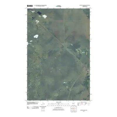
2010 Map of Upstead Lake
USGS Topo · Published 2010About this map
Hull and Toivola serve as the primary markers of human settlement in this Saint Louis County landscape, which is defined largely by its glacial hydrology and low-lying wetlands. The northern reaches are punctuated by the namesake Upstead Lake and nearby Finberg Lake, while Sand Creek meanders through the central terrain towards the eastern border. This 2010 topographic record captures the area's rural character, showing the limited road infrastructure that connects these small communities through the thick of the Minnesota woods. Farther south, Exnell Lake sits adjacent to the curiously named Devils Islands, illustrating a landscape where name-bearing landmarks are few and far between, often tied to specific water bodies or small clusters of buildings.
Find a feature on this map
7 named features on this map. Tap any name to fly to it.
Don’t see what you’re looking for? This feature index may not catch every label — zoom into the map to look around manually.
Map Details
Editions of this 2010 Upstead Lake Map
This is the sole edition of this map. No revisions or reprints were ever made.
Other maps of this area

1952 · Riley
USGS Topo · 1:24,000

1952 · Silica
USGS Topo · 1:24,000

1952 · Little Swan
USGS Topo · 1:24,000

1954 · Hibbing
USGS Topo · 1:250,000

1957 · Hibbing
USGS Topo · 1:250,000

1958 · Hibbing
USGS Topo · 1:250,000

1963 · Elmer
USGS Topo · 1:24,000

1963 · Toivola SW
USGS Topo · 1:24,000

1963 · Upstead Lake
USGS Topo · 1:24,000
1963 · Toivola
USGS Topo · 1:24,000