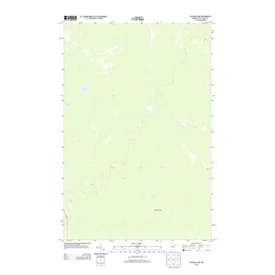
2013 Map of Upstead Lake
USGS Topo · Published 2013About this map
Upstead Lake and the surrounding wet lowlands of Saint Louis County characterize this section of northern Minnesota in the early 21st century. The landscape is defined by its glacial hydrology, where Finberg Lake and Exnell Lake sit amidst a complex network of marshes and smaller water bodies. The terrain is notably flat, punctuated by Devils Islands and drained by the meandering course of Sand Cr as it flows toward the east.
Find a feature on this map
7 named features on this map. Tap any name to fly to it.
Don’t see what you’re looking for? This feature index may not catch every label — zoom into the map to look around manually.
Map Details
Editions of this 2013 Upstead Lake Map
This is the sole edition of this map. No revisions or reprints were ever made.
Other maps of this area

1952 · Riley
USGS Topo · 1:24,000

1952 · Silica
USGS Topo · 1:24,000

1952 · Little Swan
USGS Topo · 1:24,000

1954 · Hibbing
USGS Topo · 1:250,000

1957 · Hibbing
USGS Topo · 1:250,000

1958 · Hibbing
USGS Topo · 1:250,000

1963 · Elmer
USGS Topo · 1:24,000

1963 · Toivola SW
USGS Topo · 1:24,000

1963 · Upstead Lake
USGS Topo · 1:24,000
1963 · Toivola
USGS Topo · 1:24,000