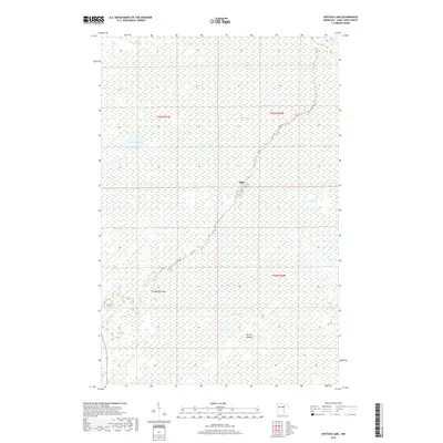
2019 Map of Upstead Lake
USGS Topo · Published 2019About this map
Hull sits at the geographic center of this wetland-rich landscape in Saint Louis County, a region defined by its complex hydrology and vast bog systems. The terrain is dominated by the sprawling Toivola Swamp, which covers much of the northeastern portion of the sheet. Large bodies of water like Upstead Lake and Exnell Lake break up the low-lying reaches, with the latter featuring the distinctively named Devils Islands. The drainage pattern is further detailed by Sand Cr, which winds through the eastern sections of the quadrangle. This 2019 survey by the U.S. Geological Survey captures the modern state of this Minnesota wilderness, emphasizing the intricate boundaries of the Public Land Survey System including Townships t55n r21w, t55n r20w, t54n r21w, and t54n r20w. This data is particularly valuable for understanding modern land management and hydrological shifts in this characteristic Iron Range vicinity.
Find a feature on this map
10 named features on this map. Tap any name to fly to it.
Don’t see what you’re looking for? This feature index may not catch every label — zoom into the map to look around manually.
Map Details
Editions of this 2019 Upstead Lake Map
This is the sole edition of this map. No revisions or reprints were ever made.
Other maps of this area

1952 · Riley
USGS Topo · 1:24,000

1952 · Silica
USGS Topo · 1:24,000

1952 · Little Swan
USGS Topo · 1:24,000

1954 · Hibbing
USGS Topo · 1:250,000

1957 · Hibbing
USGS Topo · 1:250,000

1958 · Hibbing
USGS Topo · 1:250,000

1963 · Elmer
USGS Topo · 1:24,000

1963 · Toivola SW
USGS Topo · 1:24,000

1963 · Upstead Lake
USGS Topo · 1:24,000
1963 · Toivola
USGS Topo · 1:24,000