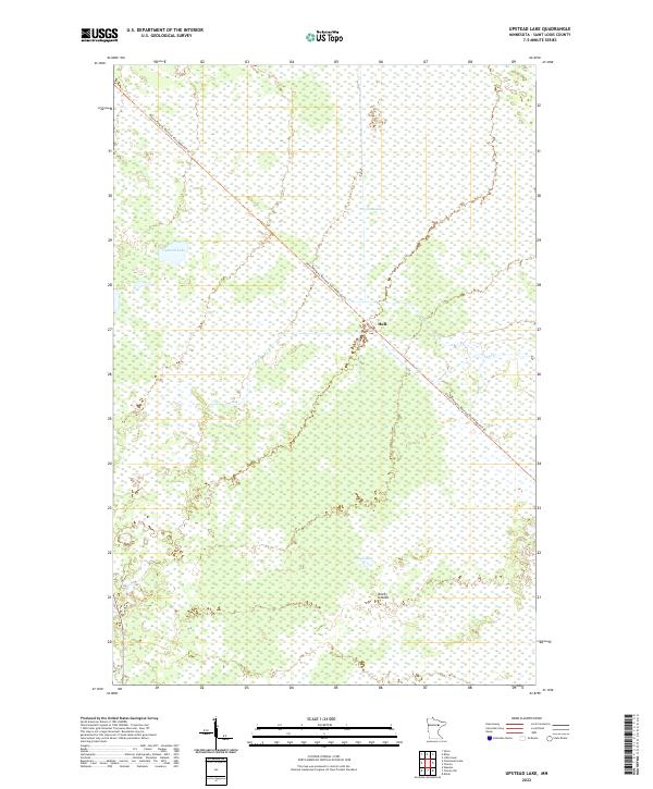
2022 Map of Upstead Lake
USGS Topo · Published 2022About this map
Hull sits at the heart of this Saint Louis County landscape, a central point within a vast network of wetlands and small water bodies. The terrain is characterized by the expansive Toivola Swamp and the distinct formation known as Devils Islands south of Exnell Lake. A significant industrial and recreational artery, the Alborn-Pengilly Railroad Trail, cuts diagonally across the quadrangle, tracing the path of former rail infrastructure through the northern Minnesota wilderness. This 2022 survey illustrates the modern conversion of historical transport corridors into contemporary trails, while the preservation of names like Upstead Lake and Sand Cr maintains a connection to the area's hydrographic history. The map provides a precise look at the township and range divisions across this sparsely settled portion of the Iron Range region.
Find a feature on this map
11 named features on this map. Tap any name to fly to it.
Don’t see what you’re looking for? This feature index may not catch every label — zoom into the map to look around manually.
Map Details
Editions of this 2022 Upstead Lake Map
This is the sole edition of this map. No revisions or reprints were ever made.
Other maps of this area

1952 · Riley
USGS Topo · 1:24,000

1952 · Silica
USGS Topo · 1:24,000

1952 · Little Swan
USGS Topo · 1:24,000

1954 · Hibbing
USGS Topo · 1:250,000

1957 · Hibbing
USGS Topo · 1:250,000

1958 · Hibbing
USGS Topo · 1:250,000

1963 · Elmer
USGS Topo · 1:24,000

1963 · Toivola SW
USGS Topo · 1:24,000

1963 · Upstead Lake
USGS Topo · 1:24,000
1963 · Toivola
USGS Topo · 1:24,000