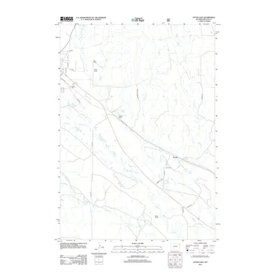
2012 Map of Upton East
USGS Topo · Published 2012About this map
The settlement of Jerome and the outlying Oliver Ranch anchor this West-central Wyoming landscape during the early 21st century. Situated near the border of Weston and Campbell counties, the area is defined by a dense network of intermittent drainages and named draws. To the northwest, the edge of the Upton town site is visible through residential streets like Pine St and Cedar St, leading toward the Greenwood Cem. The terrain rises to the southeast at Snider Hill, overlooking a series of watercourses including Pine Creek and Iron Creek. The map shows a transition from structured town grids to wide-open cattle country, navigated by functional routes such as Community Pasture Rd and Gerberville Rd. These paths trace the natural contours of the land, connecting disparate ranches across the various draws like Owens Draw and Bates Draw.
Find a feature on this map
31 named features on this map. Tap any name to fly to it.
Don’t see what you’re looking for? This feature index may not catch every label — zoom into the map to look around manually.
Map Details
Editions of this 2012 Upton East Map
This is the sole edition of this map. No revisions or reprints were ever made.
Other maps of this area

1898 · Sundance
USGS Topo · 1:125,000

1899 · Newcastle
USGS Topo · 1:125,000

1901 · Newcastle
USGS Topo · 1:125,000

1902 · Sundance
USGS Topo · 1:125,000

1918 · Moorcroft
USGS Topo · 1:125,000

1954 · Gillette
USGS Topo · 1:250,000

1955 · Newcastle
USGS Topo · 1:250,000

1955 · Gillette
USGS Topo · 1:250,000

1957 · Upton
USGS Topo · 1:62,500

1958 · Gillette
USGS Topo · 1:250,000