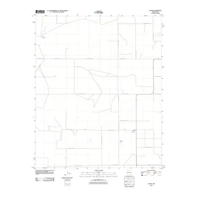
2010 Map of Upton
USGS Topo · Published 2010About this map
Upton sits at the center of this Roosevelt County landscape, defined by a rigid grid of rural roads and the intermittent drainage of Cañada del Tule. The settlement's history is anchored by the Upton Cemetery and the thoroughfare of Upton Rd, while the surrounding terrain is marked by essential water infrastructure like Twin Windmills in the northwest. The road network, including Price Ranch Rd and numerous numbered Roosevelt roads, illustrates the systematic agricultural division of the High Plains. This 2010 survey provides a clear view of the ranching and farming layout of eastern New Mexico at the start of the 21st century, showing how modern land management follows the historical township and range system.
Find a feature on this map
20 named features on this map. Tap any name to fly to it.
Don’t see what you’re looking for? This feature index may not catch every label — zoom into the map to look around manually.
Map Details
Editions of this 2010 Upton Map
This is the sole edition of this map. No revisions or reprints were ever made.
Other maps of this area

1954 · Clovis
USGS Topo · 1:250,000

1957 · Melrose
USGS Topo · 1:62,500

1958 · Clovis
USGS Topo · 1:250,000

1973 · Floyd
USGS Topo · 1:24,000

1973 · Lewiston Lake
USGS Topo · 1:24,000

1973 · Gammil Well SE
USGS Topo · 1:24,000

1973 · Tule Lake
USGS Topo · 1:24,000

1973 · Gammil Well NE
USGS Topo · 1:24,000

1973 · Upton
USGS Topo · 1:24,000

1973 · Floyd SE
USGS Topo · 1:24,000