
1973 Map of Upton
USGS Topo · Published 1975About this map
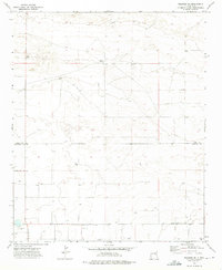
Upton serves as the quiet center of this 1970s Roosevelt County landscape, where the high plains terrain is etched by the Cañada del Tule. The map illustrates a region defined by agricultural parcels and livestock management, with fine dashed lines representing fence lines that crisscross the land. Along the Upton Road, evidence of the local infrastructure and industry appears through several drill holes and a Gravel Pit, pointing toward the subsurface resource exploration of the era. For those tracing family histories in the area, the inclusion of the Upton Cem provides a specific point of reference within this rural community. The drainage of Tule and the surrounding topography indicate a landscape where water management and elevation were critical to the isolated homesteads and ranching operations of the mid-20th century.
Find a feature on this map
7 named features on this map. Tap any name to fly to it.
Don’t see what you’re looking for? This feature index may not catch every label — zoom into the map to look around manually.
Map Details
Editions of this 1973 Upton Map
This is the sole edition of this map. No revisions or reprints were ever made.
Other maps of this area

1954 · Clovis
USGS Topo · 1:250,000

1957 · Melrose
USGS Topo · 1:62,500

1958 · Clovis
USGS Topo · 1:250,000

1973 · Floyd
USGS Topo · 1:24,000

1973 · Lewiston Lake
USGS Topo · 1:24,000

1973 · Gammil Well SE
USGS Topo · 1:24,000

1973 · Tule Lake
USGS Topo · 1:24,000

1973 · Gammil Well NE
USGS Topo · 1:24,000

1973 · Floyd SE
USGS Topo · 1:24,000
1973 · Melrose SE
USGS Topo · 1:24,000