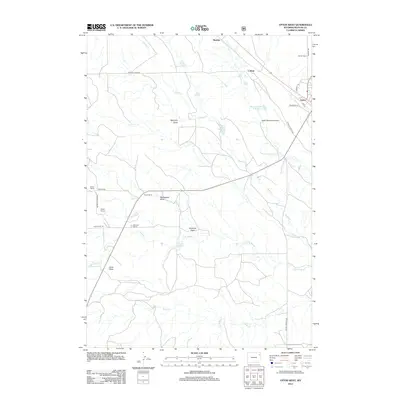
2012 Map of Upton West
USGS Topo · Published 2012About this map
Upton serves as the primary hub for this Weston County landscape, where the town's residential grid meets the Upton Municipal Airport and industrial sites like Colloid. The map reflects a classic High Plains settlement pattern, defined by family-named ranching operations such as Barton Ranch, Materi Ranch, Norris Ranch, and Shannon Ranch. Water management is central to this environment, shown through a series of human-made catchments like Materi Number 2 Reservoir, Brown Reservoir, and Little Soda Reservoir that supplement natural drainages like Beaver Cr and Coyote Cr. Topographical features such as Soda Butte and the many draws, including McCrady Draw and Stellwagon Draw, illustrate the drainage network of the Powder River Basin. This survey preserves the exact locations of these rural ranch sites and local roads such as Materi Rd and Soda Butte Rd during the early 21st century.
Find a feature on this map
32 named features on this map. Tap any name to fly to it.
Don’t see what you’re looking for? This feature index may not catch every label — zoom into the map to look around manually.
Map Details
Editions of this 2012 Upton West Map
This is the sole edition of this map. No revisions or reprints were ever made.
Other maps of this area
1918 · Moorcroft
USGS Topo · 1:125,000
1954 · Gillette
USGS Topo · 1:250,000
1955 · Newcastle
USGS Topo · 1:250,000
1955 · Gillette
USGS Topo · 1:250,000
1957 · Upton
USGS Topo · 1:62,500
1958 · Gillette
USGS Topo · 1:250,000
1958 · Newcastle
USGS Topo · 1:250,000
1962 · Gillette
USGS Topo · 1:250,000
1979 · Newcastle
USGS Topo · 1:100,000
1979 · Sundance
USGS Topo · 1:100,000