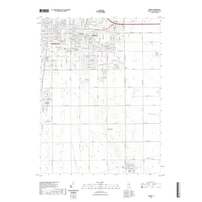
2021 Map of Urbana
USGS Topo · Published 2021About this map
The University of Illinois at Urbana - Champaign campus serves as a central landmark in this 2021 study of the Twin Cities, where the urban grid of Champaign and Urbana meets the productive agricultural land of the Grand Prairie. Notable civic infrastructure includes the Champaign County Courthouse and a dense network of local history sites, particularly several burial grounds such as Mount Hope Cem and Roselawn Cem. The landscape is defined by its subtle glacial topography, specifically the Yankee Ridge, which influences the drainage patterns of the Embarras River and Boneyard Cr. Moving south from the main settlements, the map documents the growth of Savoy and the outlying community of Philo, while features like the Day Aero-Place Airport and Saline Br Drainage Ditch illustrate the ongoing management of this highly developed Illinois prairie.
Find a feature on this map
144 named features on this map. Tap any name to fly to it.
Don’t see what you’re looking for? This feature index may not catch every label — zoom into the map to look around manually.
Map Details
Editions of this 2021 Urbana Map
This is the sole edition of this map. No revisions or reprints were ever made.
Other maps of this area

1906 · Urbana
USGS Topo · 1:62,500

1907 · Mahomet
USGS Topo · 1:62,500

1950 · Tuscola
USGS Topo · 1:62,500

1956 · Villa Grove
USGS Topo · 1:62,500

1957 · Urbana
USGS Topo · 1:62,500

1957 · Urbana
USGS Topo · 1:24,000

1957 · Rising
USGS Topo · 1:24,000

1957 · Mahomet
USGS Topo · 1:62,500

1957 · Bondville
USGS Topo · 1:24,000
1957 · Thomasboro
USGS Topo · 1:24,000