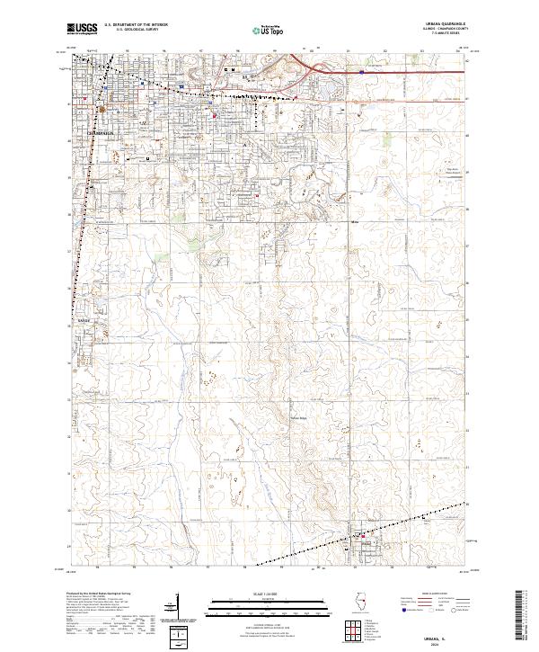
2024 Map of Urbana
USGS Topo · Published 2024About this map
The University of Illinois at Urbana - Champaign serves as a massive academic anchor for this Central Illinois landscape, surrounded by the growing urban footprints of Champaign and Savoy. The map illustrates the transition from dense city blocks near the Champaign County Courthouse to the expansive agricultural grid of the county. Notable cemeteries such as Mount Hope Cem and Roselawn Cem are situated on the university's southern edge, while the rural reaches to the south are defined by the headwaters of the Embarras River and the topographic rise of Yankee Ridge. Small outlying communities like Mira and Philo are connected to the urban core by an extensive network of county roads, including Co Rd 1600 N and Co Rd 900 N, highlighting the area's continued reliance on a structured grid for transport and land management.
Find a feature on this map
46 named features on this map. Tap any name to fly to it.
Don’t see what you’re looking for? This feature index may not catch every label — zoom into the map to look around manually.
Map Details
Editions of this 2024 Urbana Map
This is the sole edition of this map. No revisions or reprints were ever made.
Other maps of this area

1906 · Urbana
USGS Topo · 1:62,500

1907 · Mahomet
USGS Topo · 1:62,500

1950 · Tuscola
USGS Topo · 1:62,500

1956 · Villa Grove
USGS Topo · 1:62,500

1957 · Urbana
USGS Topo · 1:62,500

1957 · Urbana
USGS Topo · 1:24,000

1957 · Rising
USGS Topo · 1:24,000

1957 · Mahomet
USGS Topo · 1:62,500

1957 · Bondville
USGS Topo · 1:24,000
1957 · Thomasboro
USGS Topo · 1:24,000