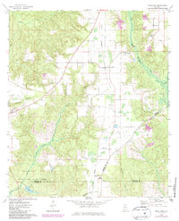
1972 Map of Uriah East
USGS Topo · Published 1986About this map
Uriah and Goodway anchor this pocket of Monroe County during the early 1970s, as depicted in this survey updated in the mid-1980s. The landscape is defined by the intersection of three counties—Monroe, Conecub, and Escambia—and the presence of the Little River State Forest. The Burlington Northern line runs north-south through the center of the sheet, while an Old RR Grade to the east reflects shifts in the local rail infrastructure over time. The rural character of the area is underscored by numerous spiritual and civic landmarks, including Oak Grove Ch, Enon Ch, and Coley Chapel. Along the western edge near Uriah, the presence of a Gravel Pit and Middle Sch suggests a local economy tied to natural resources and community-building, while Little River Lake and its surrounding forest provide a preserved greenbelt in the southern reaches.
Find a feature on this map
25 named features on this map. Tap any name to fly to it.
Don’t see what you’re looking for? This feature index may not catch every label — zoom into the map to look around manually.
Map Details
Editions of this 1972 Uriah East Map
2 editions found
Other maps of this area

1942 · Perdido
USGS Topo · 1:62,500

1944 · Perdido
USGS Topo · 1:62,500

1953 · Andalusia
USGS Topo · 1:250,000

1957 · Andalusia
USGS Topo · 1:250,000

1960 · Huxford
USGS Topo · 1:24,000

1960 · Barnett Crossroads
USGS Topo · 1:24,000

1972 · Frisco City
USGS Topo · 1:24,000

1972 · Frisco City SE
USGS Topo · 1:24,000

1972 · Uriah East
USGS Topo · 1:24,000

1972 · Excel
USGS Topo · 1:24,000