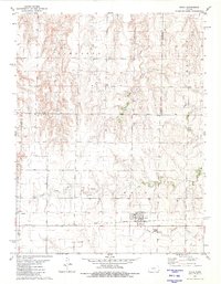
1981 Map of Utica
USGS Topo · Published 1981About this map
Utica sits at the intersection of the Missouri Pacific railroad and local transport routes in this West-Central Kansas landscape of the early 1980s. The town's layout is clearly defined against the surrounding agricultural and industrial terrain, where numerous Oil Wells and broad Oil Fields indicate the importance of energy extraction to the local economy. Beyond the town limits, the Utica Cem serves as a significant landmark for genealogical research.
Find a feature on this map
19 named features on this map. Tap any name to fly to it.
Don’t see what you’re looking for? This feature index may not catch every label — zoom into the map to look around manually.
Map Details
Editions of this 1981 Utica Map
This is the sole edition of this map. No revisions or reprints were ever made.
Other maps of this area

1955 · Scott City
USGS Topo · 1:250,000

1958 · Scott City
USGS Topo · 1:250,000

1965 · Utica SW
USGS Topo · 1:24,000

1966 · Utica SE
USGS Topo · 1:24,000

1974 · Gove SE
USGS Topo · 1:24,000

1974 · Castle Rock
USGS Topo · 1:24,000
1974 · Gibson Creek
USGS Topo · 1:24,000

1974 · Pendennis
USGS Topo · 1:24,000

1974 · Shields SE
USGS Topo · 1:24,000
1981 · Arnold
USGS Topo · 1:24,000