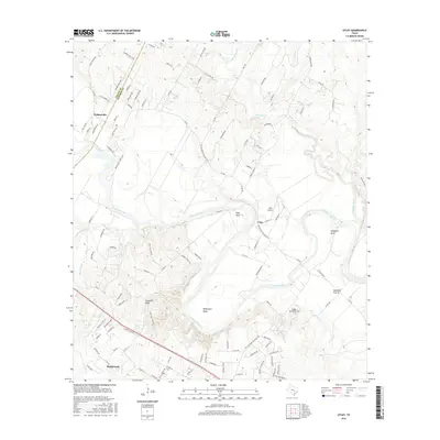
2016 Map of Utley
USGS Topo · Published 2016About this map
The Colorado River snakes through the center of this landscape, creating dramatic oxbows and landforms along the boundary between Travis and Bastrop counties. The settlement of Webberville occupies the northwestern corner, while the smaller community of Utley sits further east near the Utley Airport. The river’s influence on the local topography is evident in the naming of several distinctive meanders, including Pope Bend, Hemphill Bend, and Wilbargers Bend.
Find a feature on this map
112 named features on this map. Tap any name to fly to it.
Don’t see what you’re looking for? This feature index may not catch every label — zoom into the map to look around manually.
Map Details
Editions of this 2016 Utley Map
This is the sole edition of this map. No revisions or reprints were ever made.
Other maps of this area

1885 · Bastrop
USGS Topo · 1:125,000

1893 · Bastrop
USGS Topo · 1:125,000

1896 · Austin
USGS Topo · 1:125,000

1897 · Austin
USGS Topo · 1:125,000

1904 · Bastrop
USGS Topo · 1:125,000

1910 · Austin
USGS Topo · 1:125,000

1948 · Elgin
USGS Topo · 1:62,500

1948 · Bastrop
USGS Topo · 1:62,500

1950 · Bastrop
USGS Topo · 1:62,500

1950 · Elgin
USGS Topo · 1:62,500