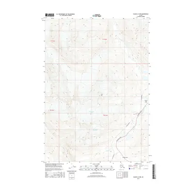
2016 Map of Valdez A-5 NW
USGS Topo · Published 2016About this map
Worthington Glacier and Twentyseven Mile Glacier dominate this high-altitude Alaskan landscape, where ice and infrastructure meet in the Chugach Mountains. The map illustrates a critical transportation corridor near Thompson Pass, featuring the parallel routes of the Richardson Highway and the Alaska Pipeline. This alignment through the mountain pass highlights the technical challenges of modern resource transport in subarctic environments. Higher elevations are characterized by the vast Ted Stevens Icefield, while drainage is managed by systems like the Tsina River, Ptarmigan Cr, and Sheep Cr. The presence of the Thompson Pass Airport near the highway junction underscores the area's role as a vital waypoint for both ground and air travel in the Unorganized Borough.
Find a feature on this map
16 named features on this map. Tap any name to fly to it.
Don’t see what you’re looking for? This feature index may not catch every label — zoom into the map to look around manually.
Map Details
Editions of this 2016 Valdez A-5 NW Map
This is the sole edition of this map. No revisions or reprints were ever made.
Other maps of this area

1951 · Valdez B-5
USGS Topo · 1:63,360

1951 · Valdez B-6
USGS Topo · 1:63,360

1951 · Valdez A-6
USGS Topo · 1:63,360

1952 · Valdez
USGS Topo · 1:250,000

1952 · Valdez A-6
USGS Topo · 1:63,360

1953 · Valdez B-6
USGS Topo · 1:63,360

1953 · Valdez A-5
USGS Topo · 1:63,360

1960 · Valdez
USGS Topo · 1:250,000
1983 · Valdez A-6 SE
USGS Topo · 1:25,000
1993 · Valdez B-6
USGS Topo · 1:63,360