
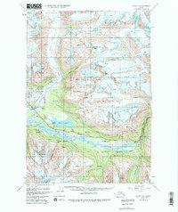
1951 Map of Valdez A-6
USGS Topo · Published 1980About this map
Glacial movement and industrial transport define the corridor between Valdez Glacier and the Valdez corporate boundary. This landscape is shaped by the massive ice flows of the Corbin Glacier, Hogback Glacier, and Keystone Glacier, which converge toward the Lowe River valley. The map reveals a complex infrastructure supporting the region's transport and extraction history, notably featuring the Richardson Highway and the Trans-Alaska Pipeline (Underground) as they navigate the dramatic passage through Keystone Canyon.
Find a feature on this map
45 named features on this map. Tap any name to fly to it.
Don’t see what you’re looking for? This feature index may not catch every label — zoom into the map to look around manually.
Map Details
Editions of this 1951 Valdez A-6 Map
2 editions found
Other maps of this area

1948 · Cordova
USGS Topo · 1:250,000

1950 · Cordova D-7
USGS Topo · 1:63,360

1950 · Cordova D-5
USGS Topo · 1:63,360

1951 · Cordova
USGS Topo · 1:250,000

1951 · Valdez B-5
USGS Topo · 1:63,360

1951 · Cordova D-6
USGS Topo · 1:63,360

1951 · Valdez B-6
USGS Topo · 1:63,360

1952 · Valdez
USGS Topo · 1:250,000

1952 · Cordova D-7
USGS Topo · 1:63,360

1952 · Valdez A-6
USGS Topo · 1:63,360