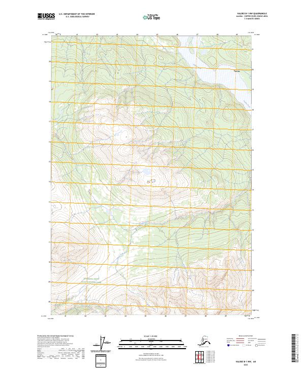
2023 Map of Valdez B-1 NW
USGS Topo · Published 2023About this map
The Chitina River flows through the northern reaches of this Alaskan interior landscape, just south of the settlement at Chitina. This modern survey documents the high-elevation transition into the Wrangell-Saint Elias National Park and the protected lands of the Wrangell-St. Elias Wilderness. The terrain is defined by a dense network of mountain drainages, including Nerelna Creek, Willow Creek, and Surprise Creek, which carve through the high country before feeding into the larger river valley.
Find a feature on this map
16 named features on this map. Tap any name to fly to it.
Don’t see what you’re looking for? This feature index may not catch every label — zoom into the map to look around manually.
Map Details
Editions of this 2023 Valdez B-1 NW Map
This is the sole edition of this map. No revisions or reprints were ever made.
Other maps of this area

1951 · Valdez B-2
USGS Topo · 1:63,360

1951 · Valdez B-1
USGS Topo · 1:63,360

1951 · Valdez C-2
USGS Topo · 1:63,360

1951 · Valdez C-1
USGS Topo · 1:63,360

1952 · Valdez
USGS Topo · 1:250,000

1953 · Valdez C-2
USGS Topo · 1:63,360

1953 · Valdez C-1
USGS Topo · 1:63,360

1960 · Valdez
USGS Topo · 1:250,000
1995 · Valdez B-1
USGS Topo · 1:63,360

1996 · Valdez C-2
USGS Topo · 1:63,360