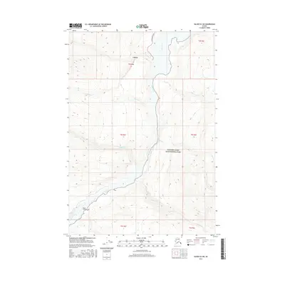
2016 Map of Valdez B-2 NE
USGS Topo · Published 2016About this map
The settlement of Chitina occupies a high point overlooking the confluence of significant interior waterways, serving as a gateway to the expansive Wrangell-Saint Elias National Park. The landscape is defined by the powerful southward flow of the Copper River, which carves through the dramatic Wood Canyon near the southern edge of the survey. This 2016 topographic study reveals the sparse but vital infrastructure of the region, anchored by the Copper River Spur.
Find a feature on this map
18 named features on this map. Tap any name to fly to it.
Don’t see what you’re looking for? This feature index may not catch every label — zoom into the map to look around manually.
Map Details
Editions of this 2016 Valdez B-2 NE Map
This is the sole edition of this map. No revisions or reprints were ever made.
Other maps of this area

1951 · Valdez B-2
USGS Topo · 1:63,360

1951 · Valdez B-1
USGS Topo · 1:63,360

1951 · Valdez C-2
USGS Topo · 1:63,360

1951 · Valdez C-1
USGS Topo · 1:63,360

1952 · Valdez
USGS Topo · 1:250,000

1953 · Valdez C-2
USGS Topo · 1:63,360

1953 · Valdez C-1
USGS Topo · 1:63,360

1960 · Valdez
USGS Topo · 1:250,000
1995 · Valdez B-1
USGS Topo · 1:63,360

1996 · Valdez C-2
USGS Topo · 1:63,360