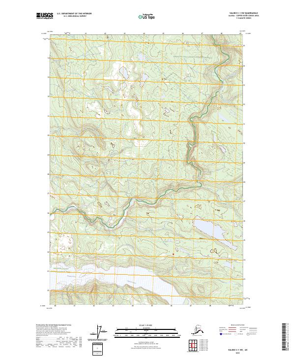
2023 Map of Valdez C-1 SW
USGS Topo · Published 2023About this map
Chitina sits at the eastern edge of this wilderness landscape, serving as a gateway where the historic McCarthy Road begins its route eastward. The area is defined by the massive confluence systems of the Chitina River and the Kotsina River, which carve through the high-latitude terrain. This region is heavily protected, with boundaries for the Wrangell-Saint Elias National Park and the Wrangell-St. Elias Wilderness meeting here. The map captures the hydrological network of the Copper River Census Area, including smaller tributaries like Iron Creek and Loraine Creek that feed into the larger glacial river valleys. The presence of the Wrangell-Saint Elias National Preserve in the northern portion indicates a multi-use landscape where traditional activities continue alongside federal conservation efforts.
Find a feature on this map
13 named features on this map. Tap any name to fly to it.
Don’t see what you’re looking for? This feature index may not catch every label — zoom into the map to look around manually.
Map Details
Editions of this 2023 Valdez C-1 SW Map
This is the sole edition of this map. No revisions or reprints were ever made.
Other maps of this area

1951 · Valdez B-2
USGS Topo · 1:63,360

1951 · Valdez B-1
USGS Topo · 1:63,360

1951 · Valdez C-2
USGS Topo · 1:63,360

1951 · Valdez C-1
USGS Topo · 1:63,360

1952 · Valdez
USGS Topo · 1:250,000

1953 · Valdez C-2
USGS Topo · 1:63,360

1953 · Valdez C-1
USGS Topo · 1:63,360

1960 · Valdez
USGS Topo · 1:250,000
1995 · Valdez B-1
USGS Topo · 1:63,360

1996 · Valdez C-2
USGS Topo · 1:63,360